


Yesterday we moved to a COE park, "Tetilla Peak recreation area" in Pena Blanca, NM
N35 38.756
W106 18.546
5556 ft ASL
It is 13 miles west off of I-25, Very pretty park with lots of mountain views and the lake from our site. There is another COE park across the lake, about 1-1 1/2 miles away as the crow fly's, but 25 miles away by road!
.Check out the co-ordinates on Google maps, satellite view, to see how rugged this area is. If you zoom out you will see hwy.4 to the northwest of us. That is one of the drives we will be taking with a side trip to Los Alamos (WW2 atom bomb)
Yesterday I had a real hard time with the internet connection, the signal kept going from 0-3 bars and I kept dropping out. While watching it, it looked like the signal was moving between two different towers, so I tried changing the settings. That has seemed to help and this morning I have not had any problems, other than a not real fast connection. Will see what the signal is like later this afternoon.
We will be here a week and take a few day trips from here. The weather does not look real great over the next several days, but we hope to get in at least two drives.
Hope you are having a great day.
love to ya
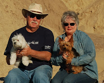
Jim and Linda
N35 38.756
W106 18.546
5556 ft ASL
It is 13 miles west off of I-25, Very pretty park with lots of mountain views and the lake from our site. There is another COE park across the lake, about 1-1 1/2 miles away as the crow fly's, but 25 miles away by road!
.Check out the co-ordinates on Google maps, satellite view, to see how rugged this area is. If you zoom out you will see hwy.4 to the northwest of us. That is one of the drives we will be taking with a side trip to Los Alamos (WW2 atom bomb)
Yesterday I had a real hard time with the internet connection, the signal kept going from 0-3 bars and I kept dropping out. While watching it, it looked like the signal was moving between two different towers, so I tried changing the settings. That has seemed to help and this morning I have not had any problems, other than a not real fast connection. Will see what the signal is like later this afternoon.
We will be here a week and take a few day trips from here. The weather does not look real great over the next several days, but we hope to get in at least two drives.
Hope you are having a great day.
love to ya
Jim and Linda


wow that looks rugged, you might need a 4 x 4 to get out, hhow come u dont post my comments, or are they somewhere and i cant see them ,,elton john is coming to Yakima, can u beleive it, tickets go on sale sat am, miss ya guys, its getting time for fishing over here, Abel
ReplyDelete